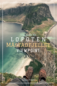
Værøy – Måstadfjellet viewpoint
Beautiful views of white beaches and turquoise waters in a scenery reminding of Scotland.
Stockholm – Bodö – Vaeroy
Our road trip in Lofoten started from Stockholm. We had a night in Sundsvall and then drove to Bodø where we took a tent night at Bodøsjøen Camping. It takes around 14 hours to drive from Stockholm to Bodø. We did not have time to explore Bodö because we booked an early ferry the next day that would take us to Værøy.
Distance:

10 km
Time including lunch & photo stop:
4 hour 20 min
Elevation:

557 m
Highest point:

434 m

Book a ferry
We had got information that it could be difficult to get a seat on the ferry, we made a booking in advance to be sure to get on. What I also had got information about was to take the ferry to the Moskenes, I did not know there were other options to get to other islands until we got there. We rebooked the ticket because we would not want miss Værøy. There are three departures from Bodö; Moskenes, Vaeroy and Rost. We experienced it as most of the people went straight to Moskenes, there were not so many tourists at Vaeroy, which was nice!
At Torghatten Nord you can book your ferry and see schedule and prices.
Måstadfjellet Viewpoint
The first day in Norway offered typical Lofoten weather – cold, cloudy, rain and windy. We were looking for the place where we would start our first hike. We parked the car on a small parking lot and started walking along an old road and entered a tunnel. (Down in the valley between Tvärberget and Hornet) There was no signs to this hike, it was a bit unclear where it started. It was not at all demanding, you could walk on a path or you could walk on a highway all the way to the top of Håheia. There is also another hike you can do to get over all the way to Måstad, check it out:
At ut.no there´s maps on other hikes at Vaeroy.

Just when we got to the top the clouds faded and the world’s most beautiful views opened up in front of us. It was magical! And steep! It tingled into the whole body of nervousness to fall over the edge haha. I’m getting more and more afraid of heights, the older I get, I can not imagine how I managed to jump both bungyjump and skydive… We stopped and took a lot of photos, and then we walked out to Skamheia. It was really windy and the position of the wind changed all the time. We cooked lunch at our Trangia kitchen, we managed to find a not so windy spot, but just when we had finished eating the wind caught us again. We walked the same way back and let Charlie have a swim down at the beach at Tverrberget. It was a really nice trip up there, it reminded of Scotland’s landscape. The rest of the day the weather shifted a lot and we drove around the island to have a look around.
We placed the tent on a field closed to the start of the hike. It was raining so we took a power nap before it was time to take the next ferry to Moskenes. That ferry took about an hour and went just around midnight so it was a perfect trip in the midnight sun! We spent about 12 hours at Vaeroy and it was enough time to explore the island.


Thank you for your report?
Could you recommend walking to the top when we carry our 9 month old daughter on our back or is it to steep? We start our trip in three weeks and it would be help to know your advice☺️
Hi! I think that would be fine! You can choose to take the road for the cars, that one is not very steep and the hike is not very far. I don’t have kids on my own yet, but I think I would definitely bring mine for hikes like that in the future 🙂 Good luck and have fun!
Thank you so much for your help☺️